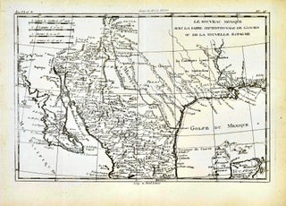
Le Nouveau Méxique, avec la partie septentrionale de l'ancien, ou de la Nouvelle Espagne [Carte de] [Map of New Mexico, with the Northern Part of Old, or New Spain]
Geneve: Jean-Leonard Pellet, 1780. Copper Engraving. Image 8.5" x 12.5"; sheet 10.25" x 14" From Raynal's Histoire Philosophique et Politique. Center fold as issued. Always securely packed and dispatched rapidly. Professional sellers of antiquarian books, maps and prints since 1994. Satisfaction guaranteed.


![Item #418558 Northern America [Canada] [Map of]. G. W. Colton, C B](https://bluewhalebooks.cdn.bibliopolis.com/pictures/418558.jpg?width=320&height=427&fit=bounds&auto=webp&v=1607213949)
![Item #418557 Canada East or Lower Canada and New Brunswick [Map of]. J. H. Colton](https://bluewhalebooks.cdn.bibliopolis.com/pictures/418557.jpg?width=320&height=427&fit=bounds&auto=webp&v=1607213949)
![Item #418613 Canada West or Upper Canada [Map of]. J. H. Colton](https://bluewhalebooks.cdn.bibliopolis.com/pictures/418613.jpg?width=320&height=427&fit=bounds&auto=webp&v=1607214250)