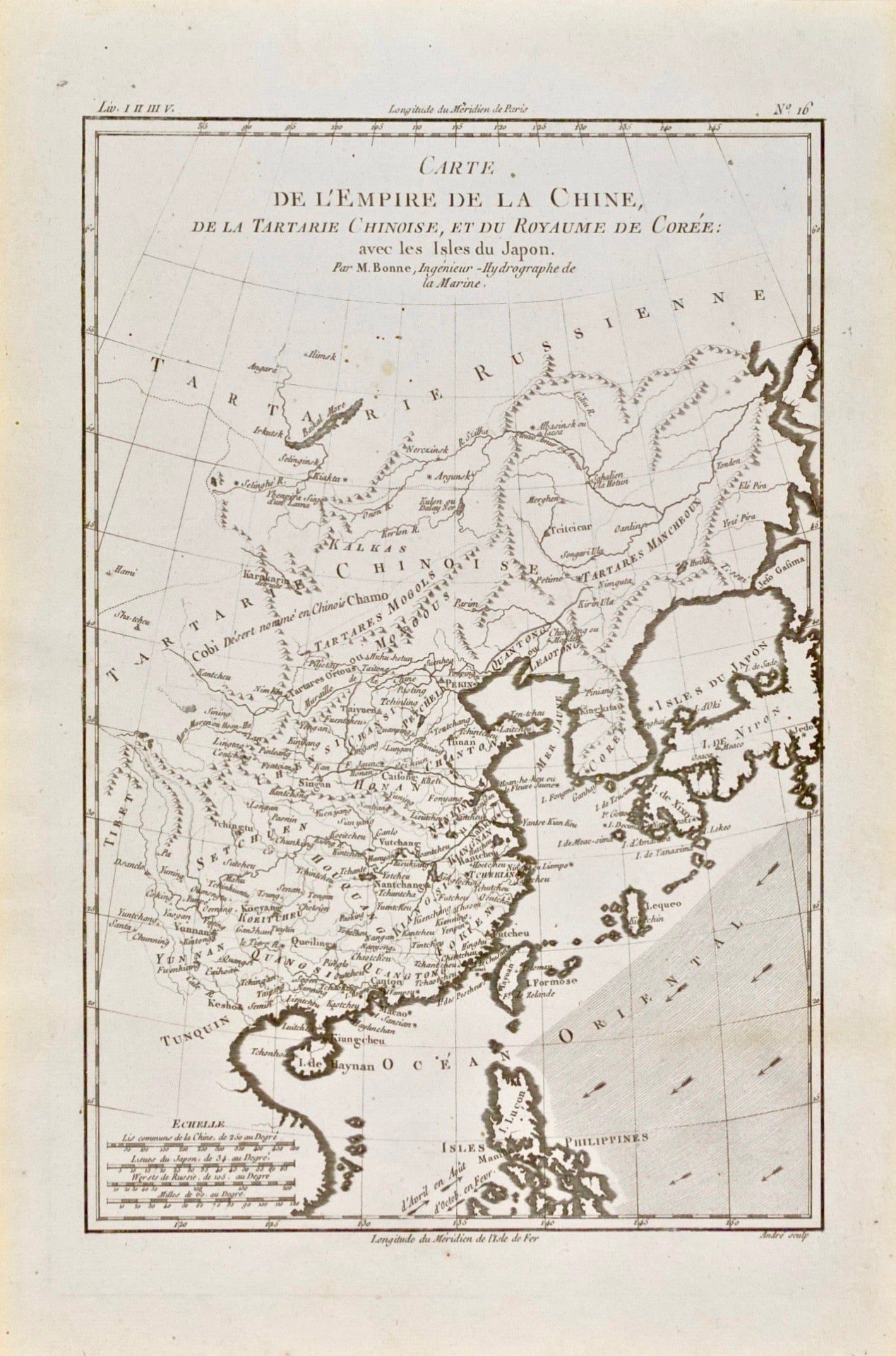
![Item #418706 Carte de l'Empire de la Chine, de la Tartarie Chinoise, et du Royaume de Corée: avec les Isles du Japon [Map of the Chinese Empire, Chinese Tartary, and the Kingdom of Korea: with the Islands of Japan [South and North Korea] [Asia]. Rigobert Bonne.](https://bluewhalebooks.cdn.bibliopolis.com/pictures/418706.jpg?width=768&height=1000&fit=bounds&auto=webp&v=1607214250)
Carte de l'Empire de la Chine, de la Tartarie Chinoise, et du Royaume de Corée: avec les Isles du Japon [Map of the Chinese Empire, Chinese Tartary, and the Kingdom of Korea: with the Islands of Japan [South and North Korea] [Asia]
Geneve: Jean-Leonard Pellet, 1780. Copper Engraving. Image 12.75" x 8.75"; sheet 15.75" x 10.25" From Raynal's Histoire Philosophique et Politique. Faint spots upper center. Near Fine. Item #418706
Always securely packed and dispatched rapidly. Professional sellers of antiquarian books, maps and prints since 1994. Satisfaction guaranteed.
Price: $195.00
See all items in
Maps
See all items by Rigobert Bonne